Blauberge (Wolfsschlucht, Halserspitz)

Blauberge is located in the south direction from Tegernsee lake and just on the border to Austria.
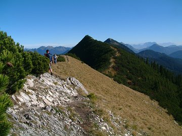
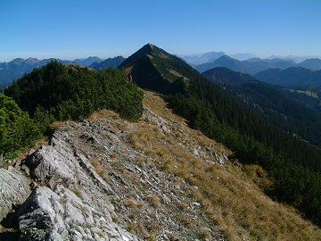
It consists of four peaks including the highest one Halserspitz (1863m). They are connected by a narrow ridge.
The south side seems to be a gentle farm while the north side is steep cliff.
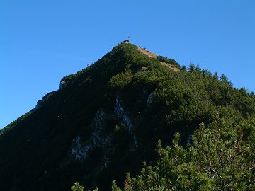
It looks like a huge blue wall from the north side. This might be an origin of this name.

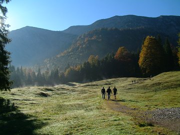
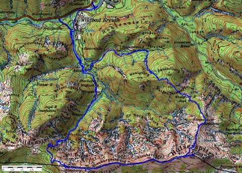
Today I hiked up from Wolfsschlucht (wolf ravine) at the east end and went along the ridge towards east.

 
(c)Bayerische Vermessungsverwaltung  isnoTOj
The track was logged by GPS and transferred to the map by editrex2

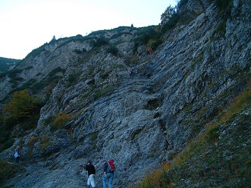
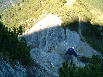
Wolfsschlucht is already reported for Schildenstein.
It is an amazing ravine with steep rock which has some steel ropes for support.
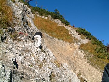
After climbing up the wolf ravine, change the direction to east bound 
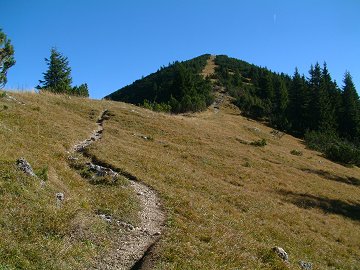
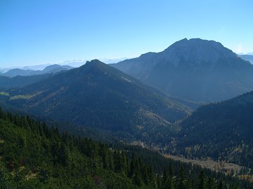
to Wichtlplatte with nice panorama view.


Autumn haze and Blauberge

Climbing up the Wolf Ravine

Passing carefully

From Wichtlplatte to Blaubergschneid

Then walking on the narrow ridge

Main Alpine and Guffert

Blaubergkopf and Halserspitz

Peak of Halserspitz

Bergdohl knows a happy lunch time

Going down along the steep rocky north terrain

Halserspitz looks not so far away but stays always far away.
Keep walking and walking, being refreshed by panoramas on both sides.
Shortly after the branch to the  north ridge, I arrived at the peak with 360 degrees' panorama!

On the way back to Wildbad Kreuth, I had to mange steep, slippy and breakable north ridge of Halserspitz.
I had to be on time for the bus to Tegernsee.
It was lucky to reach the bus stop about 20 min before.


Data:
15.10.2006
Bus stop Siebenhütten (822m, 9:30) -> Wolfsschlucht (984m, 10:25) -> saddle (1464m, 11:20) -> Wichtlplatte (1670m, 11:55)
-> Blaubergschneid (1787m, 12:20) -> Blaubergkopf (1787m, 12:55) -> Halserspitz (1862m, 13:20)@(3h50min)
Halserspitz (1862m, 13:50) -> Wildbad Kreuth (16:20) (2h30min)
(Standard duration would be 5h for up and 3h for down.)

[Back to Hiking]